Wednesday, April 25, 2012

Forcing Teewinot

Early morning light catching us while ascending Glacier Gulch
Sitting in a room at Motel 6, listening to thunder, I'm reflecting on the year and our still very long "to do" list.  Jason and I have this whole week off and planned on working on some "larger" projects in the Tetons.  Unfortunately, JD must not have been living right because the forecast today was for 80 percent chance of showers and highs in the 60s at 10,000 feet.  Sadly, this appeared to be the best day of the week so we geared up for every possible scenario and started biking to Lupine Meadows just after 3AM (road opens May 1st).


The GT in early morning light

Both of us have used this TH multiple times and thought we knew how to get around in the mountains.  The plan was to follow the summer trail to the Amphitheater Lake turnout and then head up into Glacier Gulch.  Somehow in the moonless night, we lost the trail and spent a full hour walking in a circle.  Happening upon our up track, we thought we'd found the way.  Then, seeing the freshness of the tracks through the isothermic snow, we realized we had been completely turned around.  Sheepishly backtracking until discovering our initial wrong turn, we set the course straight.

Finding more isothermic snow that was hidden by a weak rain crust after Delta Lake, we were not hopeful that we'd get anything done.  Laboring onward under the weight of heavy packs, we decided to poke around Teewinot and started up the SW Couloir.

Skinning up the shoulder of Teewinot
Scrambling over to Teewinot's summit ridge (photo by Jason Dorais)

Looking down Teewinot's East Face (photo by Jason Dorais)
The snow conditions continued abysmal but the scenery was striking.  We traded trail breaking duties and soon found ourselves working our way above the East Face and toward the summit ridge.  A bit of scrambling deposited first Jason and then me on Teewinot's wildly beautiful summit.

Jason on Teewinot's small and wild summit


Looking down into Cascade Canyon from Teewinot's wild summit
Looking toward Mount Owen from Teewinot's wild summit.  NE Snowfields visible.

Lounging on the summit ridge

Skiing the upper SW aspect of Teewinot (photo by Jason Dorais)
Entering the SW Couloir on Teewinot.  GT, Middle, and South Tetons in background (photo by Jason Dorais)


JD negotiating tough conditions in the SW Couloir

Rain crust or isothermic?

As we crossed the upper East Face on both the ascent and descent we understood our day was done.  The storm was yet to materialize but the bluebird skies and strong sun were wreaking havoc to the already poorly structured snowpack.  With the clock ticking, we reversed our course and enjoyed perhaps the worst turns of the year back to the summer trail.  There, we played the skis on/skis off game a dozen times before committing to walking through and around the slush back to the trailhead.   Unaccustomed to the bike, it was surprising to find how sore our butts were on the ride back to the car  and the end to our woeful adventure.

Sore butts and heavy loads

Still psyched about the day
With continued unsettled weather in the Tetons, a poorly structure snowpack, and a rapidly receding snow line in the Wasatch, I wonder if the year is over?  Teewinot was a good consolation prize but I'm still eager to explore a bit more.  We have a few days to mull it over, but for now, we're turning tail and heading back to SLC.  Every year I shake my head at all those impatient souls who hang up the skis and start mountain biking in the mud.  While I don't bike, it might be time embrace that idea and start hitting the trails (on foot).  

But then again, next week the weather looks cooler in the Tetons...


Wednesday, April 18, 2012

Lone Peak: First Descent?

Last year I spied a discontinuous, rather contrived ski line from near the summit of Lone Peak down into the cirque.  Jason and I tried to climb the mixed section but were turned around rather quickly before thoroughly enjoying the lower couloir.  Yesterday, Josh Anderson jumped at the opportunity to explore some new terrain (he just moved here last year) on one of our more proud mountains.
A new line?  Even if this has been done before and has a name, I'm calling it the Lars Line from here onward.
I picked him up at 5am and after consulting the internet, found Hidden Valley Park, jumping off point for the Sawmill trail and Big Willow Canyon.  Here, we readied ourselves with ropes, pins, crampons, and other assorted junk.  Heavy ladened, we were finally off around 5:40, feeling our way by headlamp.  Josh's skis catching on nearly every possible branch of scrub oak foreshadowed later events as the sweat began to roll on the steep trail.

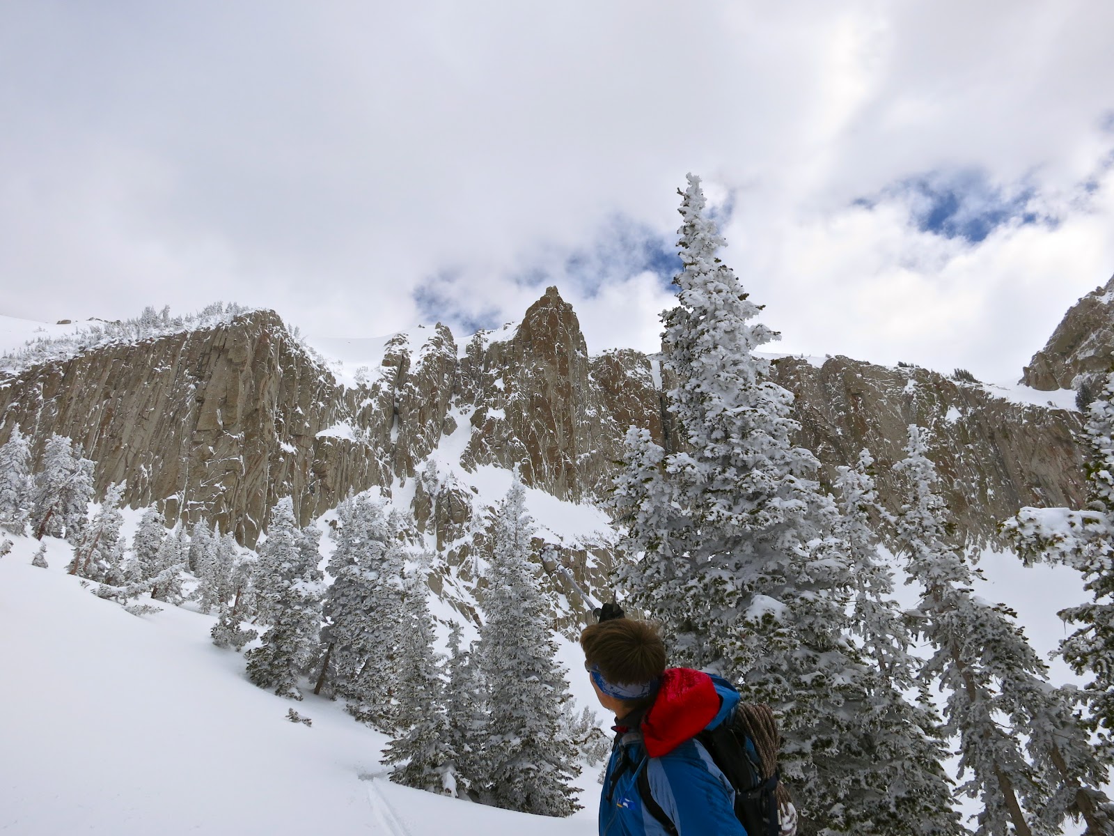
A lot of good looking rock in Big Willow Canyon
Unfamiliar with the approach into Big Willow, we followed the trail as long as possible before the terrain opened and the dawning day revealed awesome ski potential, even in the lower canyon.  Today however, the goal was higher.  Big Willow was chosen as the approach so as to explore a new corner of the Wasatch. 

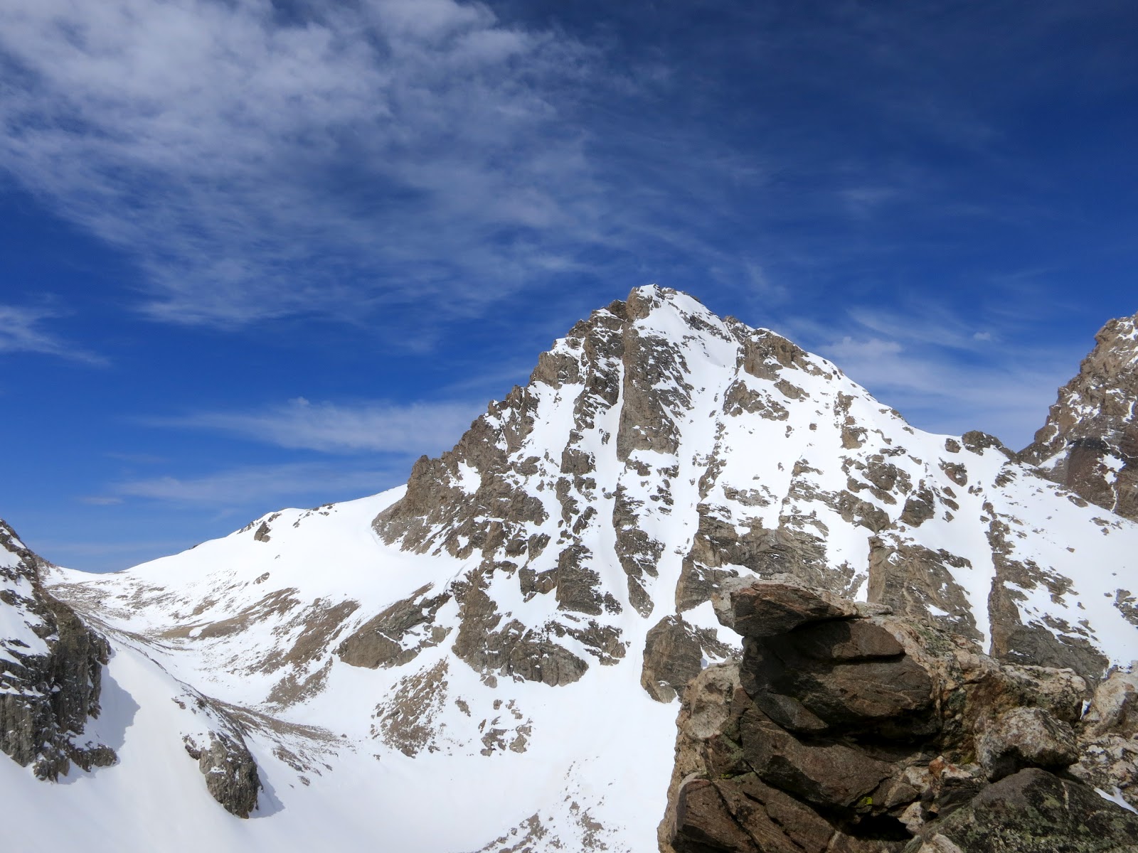
Initially firm, conditions soon softened and made for slow travel.  Once in the upper reaches, we became concerned enough about the conditions to stick to a sub ridge, avoiding the wind board over 3-4 feet of recent drifts.  A quick pit revealed a couple different layers failing on isolation.  Spatial variability?  As we climbed the ridge, my eye was drawn back to the "Notch" and its steep short couloir.  This smallish feature is highly visible from I-15 and is already on the 'to do' list.  

The Notch, visible from I-15 and home to the classic rock climb, Giggles
Alternating between skinning and boot packing a small sub ridge
Along the gentle portion of the summit ridge
Lone Peak's summit starting to appear
A couple rock moves later, we pulled out onto the gentle lower portion of the summit ridge.  The air was clear and frozen, seemingly an extension of the new rime that was grazing the hearty vegetation.  We skinned until the ridge fell away steeply on both sides, thousands of feet to the east and hundreds of feet to the west.  To the left I could look down and see the Northeast Couloir and to my right, our intended line: a steep short couloir that opens into space as a 50 meter cliff, before continuing into the Cirque as a beautifully steep and exposed series of ramps and chutes.  In reality, there are two options for the initial descent that both converge after the rappel.  My first choice was the snowfield/chute that descends immediately from the summit block to the NW but this appeared rocky and too spicy for a Monday.  Instead, we chose the chutelette to the north and were happy as I was still able to ski from a bump on the ridge and feel like it was from a summit. 
The more spicy portion of the summit ridge
The two chutelettes: Upper left from summit and foreground from small bump on ridge.  They are divided by the small rocky spine but converge below the 50 meter cliff
However, it was here that our dilemma ensued.  We knew the snowpack was suspect and a friend of mine was recently injured in a slide when a wind pocket pulled out, strafing him through some talus.  Even though this upper section was only 100 feet or so in length, the consequence of even a small slide would be death.  Not one hundred percent sure (or even close), we chose to ski belayed.  While some may view this a cowardly exit, I'm not as opposed.  Style wise, free and clean as in climbing would have to be the most pure.  To ski on belay I think can be equated to the "murder of the impossible" as Messner called the submission of climbs through siege tactics and fixed gear.  However, to not ski that upper section with a rope would have been a game of Russian Roulette.  How many bullets need to be in the chamber?  
A look back up the upper chute from the rap anchor
Looking down from the rap anchor
As it happened,  I descended first, on belay and made a series of tight ugly turns until I could pull over and build an anchor. Fortunately, the upper chute felt stable, albeit shallow and rocky.  Regardless, I am glad we skied belayed and look forward to hearing about the next guys or gals with bigger balls than me, who are able to advance the style meter.  I then brought Josh down on belay before heading off again with the rack, unsure if the ropes would reach the lower couloir.   

Rapping over the edge, I took in the ice flutings and chimneys and marveled at how cool the climb up would have been.  Yelling, "off rappel," it was then Josh's turn and down came his wash of snow and ice as he made his way.  Now established in one of the coolest spots in the Wasatch, we skied the same line that Jason and I did the year before and with Question Mark Wall as the back drop, I shot photos of Josh while grinning at how incredible our day had been thus far.  
Looking up from mid rappel
Looking down from mid rappel
Josh on rappel
Josh, working his way into the cirque
More Josh, more Question Mark Wall
The little sneaky right hand dog leg to the lowest chute

Big walls, April Powder, and a new line?
The Lars Line?

Josh pointing out the descent

One more because it's so beautiful
The lower couloir is really a chute connected to a chute by a little 50 foot right hand sneak and oddly, the lowest SW facing section held the best snow of the day.  From there, we debated climbing out of the cirque and descending back into Big Willow or heading along the Draper Ridge and eventually angling skier's right to meet up with the Crow's Feet and the lower Big Willow Drainage.  We opted for the latter, arguing that this way we could explore twice as much terrain.  Turns out that for someone who has stared at those lines for years, I had no idea where they were located.  We did indeed try to find them but were off multiple drainages.  

Our exit meandered through low angle meadows where the snow was confused about if it should be powder, sun crust, or glop.  Not really caring, we kept traversing skier's right, thinking that "just over the next ridge" we'd find our home run shot.  Well, just over the next ridge led to another and another and eventually a wet stream bed surrounded by the most vile and densest scrub oak.  What ensued was a lot of desperate thrashing, swearing, and odd jerking as every piece of clothing and gear was attacked by the snarly little branches.  After a couple hours of this I contemplated leaving my gear to make a smoother exit as I had to be at work that evening and our progress was disheartening at best.  But, feeding off Josh's surprisingly cheery mood, I pressed on, thinking that this was the humbling price for such a brilliant morning.  
The first level of hell


Deep into hell
Eventually, a barely perceptible deer trail led to more established game trails.  Then we were half jogging in our ski boots laughing and claiming salvation.  

One more patch of terror brought us back to reality before finally breaking through and landing on a real trail above the Bonneville Shoreline.   Then it was a blister on my toe and some achy old bruises that kept me from really enjoying the ease of travel.  Oddly, we ended up at the top of Kodiak Court, where I took off my boots and walked down the asphalt in socks to a nice patch of grass where we waited for a rescue from Josh's lady, Anne.
What just happened to us?  And where is Pioneer Rd and Kodiak Ct?  

So there it is.  A new line in the Wasatch?  Maybe. There was no evidence of prior rap anchors although I believe that gully is an actual climb.  I don't know of anyone else that has been stupid enough to carry a bunch of stuff to the summit of Lone Peak just to make a few turns and rappel over a big cliff.  Pretty contrived, I know.  But, the Cirque is a magical place and that very line is visible to a million people.  At some point it becomes less about the skiing and more about exploring the mountains and getting to wild places.  I guess that's why I got into climbing/skiing in the first place.  
So, if anyone knows some one who has skied the Lars Line in the past, I'd love to hear about it.  BTW, the name is after my new boy, Lars, who is now 4 months old.  And, for what it's worth, the other variation from the summit is still waiting...

Baby Lars admiring the Tetons on a recent visit
Gear List:

Skis: Dynafit Nanga Parbat
Bindings: Dynafit Low Tech
Boots: Dynafit TLT Performance
Poles: Black Diamond Whippets
Rack: BD Angles and Lost Arrows
Ropes: 2x70m Half Ropes (HEAVY)
Harness: BD Couloir
Ice tool: BD Venom with hammer
Clothes: Dynafit tights and OR Ferossi Hoody
Food: None - sour stomach that day

Friday, April 13, 2012

Tuesday in the Tetons: Glacier Route, East/West Hourglass

Sunrise over Garnet's South Fork
Last week, I received a text message from another candidate for "most consistently happy man alive," Chad Ambrose.  It read, "Early next week's weather looks pretty nice in the Tetons..."  That sparked a flurry of replies from both me and Jason trying to convince Chad to go on our respective days off.  The forecast called for better weather on Tuesday so Jason got the boot.

The plan was to drive up after work on Monday, try to catch some sleep at the trailhead, and then ski the Ellingwood Couloir on the Middle Teton.  Always trying to imagine the perfect day, I suggested we link that up with the Chounaird and SW Couloirs and then the Glacier Route for a type of "quadfecta" or Middle Teton Project for lack of better name.  However, both of us decided on the way up that if we could just ski the Ellingwood from the summit then the day was ours.  The rest would be gravy.  Steep white gravy.

I've been battling a cold for two and a half months (ever since Lars started daycare), so I opted to pay the $45 for a room at Motel 6.  This allowed three and a half hours of dark, dreamless sleep, effectively recharging my battery.  Poor Chad, twitching with nervous energy and unable to escape my snoring, passed those three hours with his thoughts and bright eyes.

By 4 am, we were skinning from the Taggert TH, following frozen tracks by a mix of moon beam and headlamp.  Using ski crampons, we easily ascended the steep lower reaches of Garnet and another hour later, the dawning day revealed the great basin that forms the South Fork of Garnet Canyon.

I was surprised at how accessible the Ellingwood is while we readied our crampons.  Initally, I was worried we'd be too late to safely ski these steep lines on such a warm day.  Now, using French technique to ascend, I was curious if we were too early.

Chad frenching his way up the lower Ellingwood


Firm conditions in the lower Ellingwood

Front pointing up the rock hard Ellingwood

The firm conditions made for fast travel and we quickly found ourselves at the notch, looking toward the summit block.  Here, Chad courageously and wisely declared that the Ellingwood was too bullet to ski within his margin of safety.  I brushed him off and said it would be fine corn by the time we tagged the summit.
The setting moon between the Ice Cream Cone and South Teton


Chad booting with the Mark of Zoro visible on Cloudveil Dome

Topping out the Ellingwood

We worked our way up the East Face, passing a few rock bands along the way.  Each one reinforced my suspicion that I haven't climbed enough in the past couple years and feel awkward on rock, particularly with ski boots, crampons, and skis on my back.  Time to get back to the vertical I guess.  Climbing rock really does lesson the relative verticality of ski lines as one becomes accustomed to the steepness of rock routes.

Awkward rock scramble

Chad Ambrose punching it for the summit
We topped out a little before 9 AM and took in spectacular views of the surrounding peaks.  The air was warm and calm and if it weren't for a nagging sense of urgency to get down and off the East Face, we would have lounged around for a while.  Looking to the north, it was obvious the Grand had been skied multiple times in the last day or two.  Irrationally or not, this gave me a bit more confidence to lay tracks down the steep snow fields from just below the summit of the Middle.

Chad Ambrose, happy man, father of 4, and bad ass

Middle Teton Bench Mark with Nez Perce and the East Hourglass in the background

The GFT!

From the summit of the MT looking west
With the still air and rising sun, it was time to go.  On the ascent, the snow was punchy in places but the overall energy felt low.  We trusted the stability for the moment but wet slides seemed imminent with day time heating.  I made an initial pathetic ski cut before pulling into an island of safety.  Waving Chad through, I expected him to tuck into the next safe zone.  Seconds later, he was halfway down the upper East Face, navigating a small cliff band above the notch.  When my turn came, I couldn't believe our position and the soft conditions.  I had hope that my promise of corn in the Ellingwood would be fulfilled.
Steep upper aspects of the East Face of the Middle Teton

Skiing down to the Dike Pinnacle.  Glacier route is to the left, Ellingwood to the right.
Once regrouped at the notch, I dropped into the Ellingwood to "prove" it was soft.  My first couple turns were met with that horrific sound of metal on hardpack and I sheepishly looked up at Chad who was wagging his head.  Damn.  I booted back out and we decided to eat a snack and wait half an hour for it to soften.  On my next entrance, the first turn was buttery smooth, the second a bit grating, and the third bone jarring.  It still wasn't even close to ready.

Here, Chad very honestly and refreshingly stated that he had a duty to self and family and preferred to ski the Glacier Route with its promise of creamy powder.  Feeling a duty to partnership in the mountains and happy to ski powder over stressful boilerplate, we bailed on the Ellingwood and the remainder of the Middle Teton Project.  I have no doubt that we could have waited and scored the Ellingwood in ripe corn but to do so would have been at increased risk of wet slides from above.   We followed a feeling or premonition and have no regrets.

Below is the alternative:


Off the Glacier and looking for more sheltered skiing, we considered our options.  Both Hourglass Couloirs were still shaded and suggested soft conditions.  Lacking steep, stable powder in the Wasatch this year, we decided to go looking for more after thoroughly enjoying the Glacier Route.

Ascent pics of the East Hourglass:
Approach apron to both Hourglass Couloirs with Middle Teton in background. 

Boot track up the East Hourglass Couloir
Chad's butt on display at a short rocky choke, complete with fixed rope.

A look back at the Middle Teton from the top of the Sliver/East Hourglass

Looking down the Sliver

Chad, topping out the East Hourglass.  Skis left just below the last rock choke.
Thoroughly impressed by the ambience, pitch, narrow walls, and darkness of the East Hourglass, we were psyched to leap frog each other down this highly underrated couloir.  From the top, we down climbed the upper 20 feet of rock, skied the steep 50-55 degree hallway to the main rocky choke, down climbed some more, and then laughed our way down the rest.  

Descent pics:
Upper East Hourglass - above the rocky crux

Tight turns in the upper East Hourglass
Nearing the rocky choke


Exiting the East Hourglass
Standing at the confluence of the Hourglass Couloirs, the right thing to do was to then climb and ski the West.  Striving to always choose the right, up we went.

Middle Teton from the top of the West Hourglass.  Ellingwood and East Face visible.

Cloudveil Dome

Cloudveil Dome, a Bell bike helmet, and a bad ass
We lounged around at the top, reflecting on our amazing day.  We hadn't skied what we initially intended but did find around 10,000 feet of beautiful climbing and skiing.  We were loyal to each other and felt we were safe in our travels.  I wish that daylight, food, and time could have been stretched to permit a couple more lines but the clock was ticking.  As is nearly always the case, we both had to be back in SLC within 24 hours of leaving.

Down we went...
Getting started in the West Hourglass
Still finding soft snow around 1PM
                    
Frozen but untrustworthy 
Looking back at the high peaks from the trailhead, I'm sustained for another few weeks.  Hopefully, the next weather window aligns with my next bit of free time.  And, hopefully Chad Ambrose will be back! It's hard to find strong, honest, happy partners that will always try to make the right call.  And by "right", I mean as Bart once said, "The goal is to come home safe, friends, and successful, in that order".   Success can have many definitions in the mountains and completing my prescribed Middle Teton Project is just one form.  I'd say that skiing big lines in stable powder on Chad's first ski trip in the Tetons after a long winter of dangerous conditions would be just that.

The Cathedral Group