Monday, May 23, 2011

Trans Zion Run

WD getting started on West Rim Trail
With the chaotic, continually unsettled spring weather, I began looking for a desert adventure once it became clear that my Teton dreams were going to go unrealized this year.  Not having done any real climbing since October, the Zion "Free and Clean" book looked daunting. I've been hearing reports about the Trans Zion Run and managed to get psyched on the idea and talk brother JD and Warren D into coming along.   So, what follows is a LONG report of the LONG (for us), 48 mile classic "adventure run" across Zion National Park.   


Untitled from andy dorais on Vimeo.


The excuses/disclaimers:

We have skied a lot this year and probably don't have any right to complain about not having a good aerobic base even though things have tapered off drastically over the last 6 weeks.  But, the transition to summer hasn't quite taken place and I think we could count on two hands the number of runs we've been on in that time between the three of us (think sloppy soft legs).  

First of 12 bars

And, my longest run ever was a disastrous 50K.  Jason and Warren have both struggled to finish slow marathons for which they were unprepared.  I don't know why it seemed like a good idea to go so many miles longer than we'd ever been before but we didn't really question the possibility.  Adding to the foolishness was our disregard for the logistical planning that should take place on a big run like this.  


We glanced at a couple maps at REI but were too cheap to buy them, read a couple TRs online, and somehow figured we could make it the last 37 miles with only two liters of water.  We were wrong.   


Looking down at Angel's Landing from the Weeping Rock descent 9 miles in
Getting tight 1/5 of the way
JD, AC (a sweet girl that Jason has tricked into liking him), and I pulled into Kolob Canyon around midnight and slept on the side of the road.  WD, who dropped everything last minute to come, pulled in at 5:00 AM and managed 30 minutes of sleep before we pulled him out of his bag.  We left Warren's car at the Lee Pass TH, and headed over to the East Entrance of Zion, en route picking up breakfast burritos to fill up for the impending starvation.  


After last minute bathroom stops, changing, and packing our small packs, we were finally off, just after 8:00 AM.  The West Rim Trail is about 10 miles long and mostly descends as it makes it's way toward Zion Canyon.  We made ourselves run conservatively through this section and tried to drink as much as possible since we'd be able to fill up at the Grotto 11 miles in.

At the Grotto, we were met by AC, who joined us for a hike to the shoulder of Angel's Landing.  From there we were off into unknown territory with now less than two liters of water each and about 34 miles to go.

Looking back at the Cerberus Gendarme, Weeping Rock, and Big Bend

Wild formations kept us distracted from thinking about how terrible things would soon become
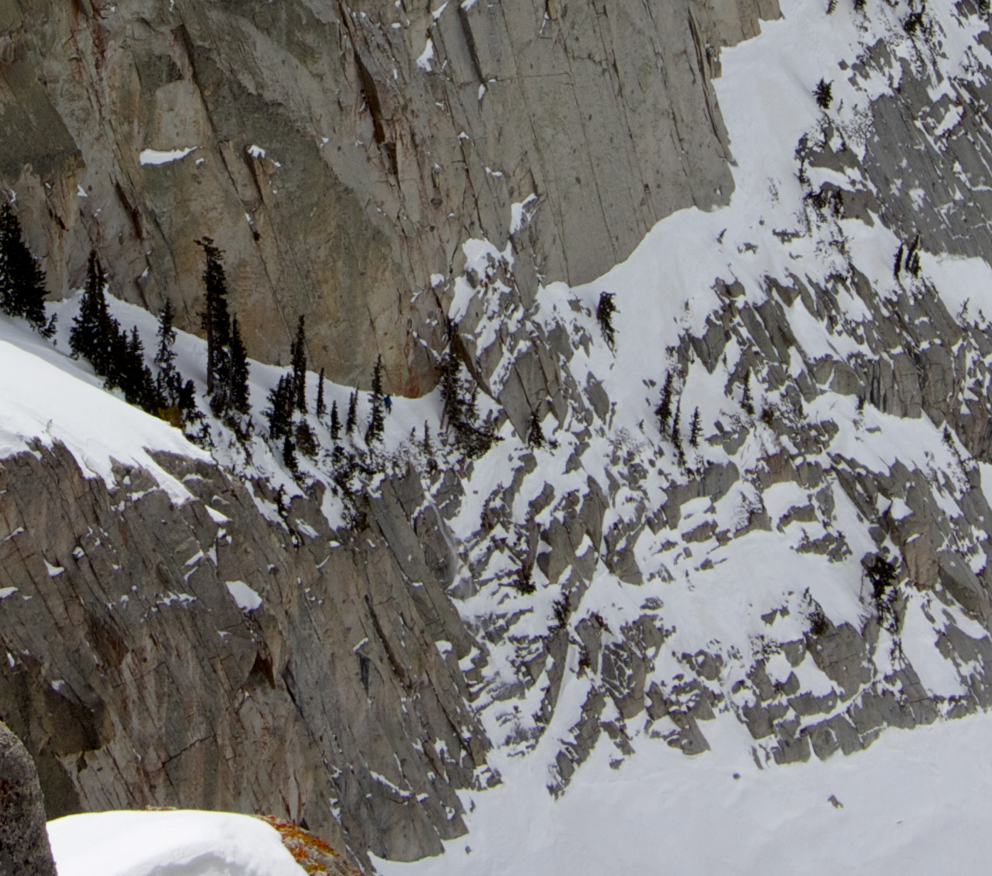
The trail ends up going along the edge of this cliff

I can name the formations from the canyon but from this side it was all a mystery
16 miles in, WD began to lag a bit.  He recognized that in order to finish the day he was going to have to go his own pace and ignore any jeering from me and Jason.  The struggle was on...
WD on the West Rim Trail
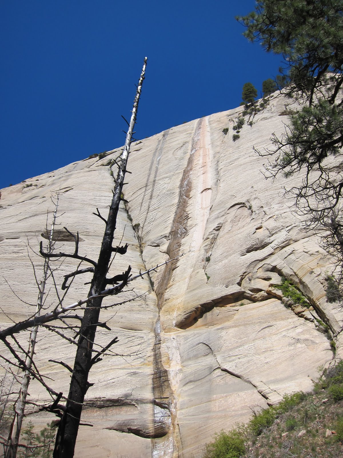
High on the West Rim, the conditions were great with cool weather and mostly dry trails.  Throughout the low lying and treed sections, conditions were abysmal with standing water and mud everywhere.  Leery of wet feet so early we did our best to walk around/through/and over those sections without falling in.  
Me and Warren somewhere along the West Rim

More West Rim scenery

There were still abundant wild flowers, although most were just past their prime.  

At some point, we reached the Wildcat Trail intersection and realized we were about 6 miles farther than we had thought which was pretty encouraging.  Discouragingly, Warren was now out of water with 23 miles to go.  Encouragingly, Warren is a G and tapped into his deep reserves, and began running faster and more steadily from here out.  


A look down Wildcat Canyon
Once on the Connector Trail, we figured it was in the bag.  Only 17 more to go (It might not have been such a given as it took us a few tries to do that math)...
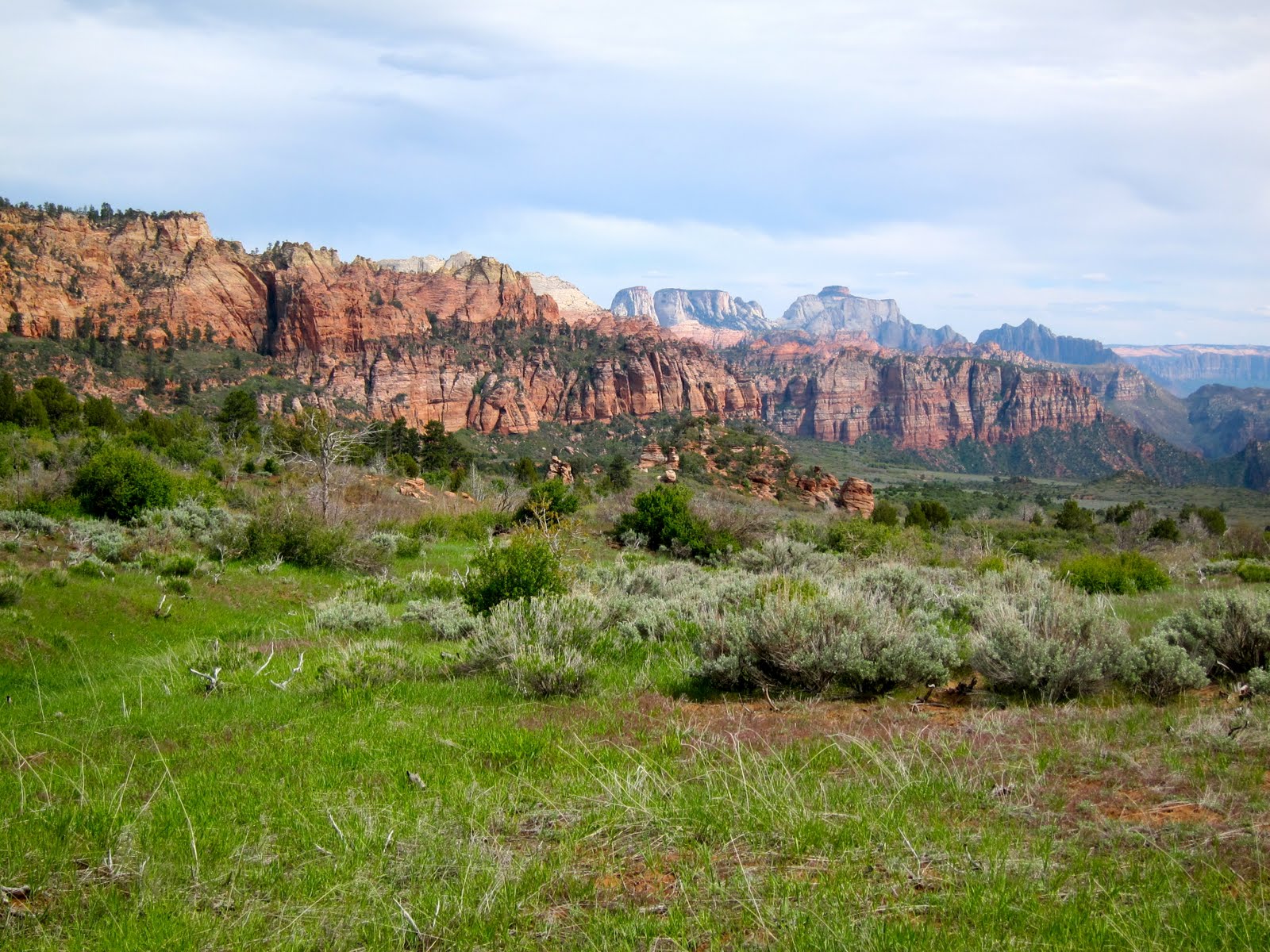
Along a high plateau on the Connector Trail 
At this point we were resigned to the fact that we'd be drinking from the feces infested streams in Hop Valley and along the La Verkin Trail.  But, we thought we'd try and barter with backpackers, hoping they'd trade some of Warren's nasty Cliff Bars for some water purification tablets.  We felt like thirsty pioneers.  Warren's prayers must have been answered because 1/2 a mile from the Hop Valley TH, a couple guys told us they had stashed a gallon of water that they didn't need any more.  Salvation.  
13 to go with water logged bellies
The Hop Valley trail was stunningly beautiful once we descended into the narrow stream lined section.  It was incredibly green, providing lush contrast to all the red.  While completely runnable, the sandy trail was interrupted countless times by the punky little stream leading to multiple slow crossing and a couple wet feet.
JD looking for Kolob

WD pioneering

6.5 to go.   JD looks like he might have a stroke and I don't believe WD's "thumbs up"
As we were descending toward the La Verkin river, a couple hikers told us to cross upstream from the trail where the water was calmer.  We made a few false starts before Jason found a passable section.
Ole fashion swimming hole

Our money was that he was going in...  Luckily he didn't

The next 6 miles were a falling apart of sorts as each of us had our unique set of body parts that was beginning to ail us.  Ignoring the discomfort, we shuffled along, making dozens more stream crossings, before the wheels came off.  A mile or two from the end we looked back and Warren was gone.  Too bad.  It was every man for himself.  Then, with the road (finish) in site, JD decided to pick up the pace to try and sneak in under 12 hours.  I followed suit, trailing behind by a minute or two, before finally stumbling out to the Lee's Pass TH after 11 hours and 58 minutes.  


Kolob Canyon on fire
Warren went through his own mind games before deciding he didn't want to spend the night in the woods and ran it in a few minutes later.  
Three lucky idiots


The goal at the outset was to have an adventure, which to me often means starting out with an uncertain ending.  By finishing, we all felt pretty good about the day.  Even if we hadn't stopped to eat, take pictures, and laugh at each other, our time was mediocre at best but I think we learned a few things.  Next time, we'll arrange for more water via stashes or support.  We'll train (more specifically) for the distance, and we'll bring more palatable food (WD only had bars).  To take off a few hours seems completely reasonable and this fall we'll be back to try again.

 That was a loooong post for a long day.  

48+ miles
~10,000 vertical
5 GUs
2 Probars
2 Twix Bars
Electrolyte tabs/nasty Nuun drink

Saturday, May 14, 2011

Ciochetti's Ribbon in May

Yesterday, Adam and I decided to try our luck on Friday the 13th.  Somehow, we ended up at Alta looking up at Devil's Castle and Ciochetti's Ribbon - the ultra thin uppermost strip of snow. 

Side view of the Devil's Castle and Ciochetti's Ribbon (upper snow ramp from right to left) 
We weren't sure how the conditions would be since it's been so hot lately with poor overnight freezes, but the skin up to the Castle was on firm consolidated snow.  We wondered if we might have to sit around to wait for a thaw but then realized it was going to be 80 degrees in the Valley and if anything, we'd be racing the massive impending thaw.

The Devil's Castle viewed head on.  The ribbon is the obvious upper strip of snow traversing from left to right. 
 The Ribbon is more like an alpine rock climb than a ski descent.  But, we had our skis on so...
Getting started, looking down the untracked Ribbon
My partner for the Day was Adam O.  He doesn't have much climbing experience so I got to go out in front and place all the protection and build the anchors.  Oh yea, we skied roped up.  I don't think it would be too unreasonable to ski it without a rope for 99.5 percent of the way, but there's this one section...
Here's what hundreds of feet of exposure look like.

Adam belaying as I take a break from trying to figure out  how to get around the "block".
Skiing around the "block" is probably the crux of the descent - or maybe just mentally wrapping one's mind around the constant exposure is.  Anyway,  I decided a 6 inch strip of snow on the very edge of the cliff to be "unskiable" and looked for an alternative way around on foot.
Still trying to figure out how to get around the "block" (photo courtesy of AO)
Eventually, I figured I brought crampons for a reason and just climbed across.  Just on the other side I had some difficulty finding a suitable anchor but reasoned 2 pins and 3 cams in iffy rock ought to do the trick.
Adam being forced into some rock moves that suited him just fine.  
Just after the block though, AO stated that he was at his wits' end.  He stretched em a bit further. 

Difficult anchors seemed to be the theme as one of them ended up being off both my skis buried as pickets and backed up by a shady cam.  I had heard there are numerous bolts along the traverse but only saw one.  Adam saw another after I already went by at ankle level.  Many were probably covered by snow.  Part of the dilemma was trying to find a protected area to belay as the day was warming up and the upper face was shedding small projectiles.  
I think this pick helps display the foolishness of the day
It felt like the Ribbon would never end because adding rope work to skiing makes the pace more akin to climbing.  We finally made it off the Ribbon and into the gully on the looker's left of the Castle.  I thought we'd be able to open it up and enjoy some turns but I only got in two.  A bit more side slipping and I was through the cliff bands, rewarded by slushy turns through old debris.  
Adam is the black dot, still high on the Castle with some cliff bands to negotiate.  Felt good to be back on the apron. 

Really good.
My ski days are numbered.  I predict only 4 more this season...

Saturday, May 7, 2011

Grand Teton Recon

Nate slipping on race skins

I've been itching for a bit of a change in scenery so for my day off this week I made a quick trip up to the Tetons to see if I could add fuel to my already intense desire to ski some of that stuff.  I joined local NB and our plan was to climb the North Ridge of the Middle Teton and then ski off the SW Couloir in an effort to smooth out part of a future traverse.  We figured that would be the most fun way up and the safest way down since there seems to be some lingering instability in the snow pack, although the consensus appears to be that up to around 11,500 feet conditions are decently safe.  

The day dawned clear but the predicted overnight freeze failed to occur at the lower elevations making the approach to Garnet through the isothermic mess a real time sink.

Once at the Meadows, conditions hardened and we were able to move quickly.  By all signs, it looked like we'd have a fabulous day.

Nez Perce and the Middle Teton

Spooky Face
As we traveled through the Meadows, a solemn feel took the air as we passed by the site of the huge recent SAR recovery effort.  It's sobering to realize that such a mistake could be so tragic.

The Spooky Face high on Nez Perce did not help the mood.

After booting up though a punchy lower headwall, we were greeted by incoming clouds, high winds, and snow flurries.  It didn't take long to agree to bail on the idea of spending the morning high on the Middle, trying not to get blown off.  Instead, we headed for the Teepee Glacier so I could get a better look at some future projects.  


Nate in the talus heading for the Teepee with the Middle Teton in the background

The evocative Grand Teton hiding in the clouds


We traveled up onto the Teepee where still finding seemingly stable snow, I began to become intoxicated by the allure of the Grand.  I wanted to "just keep going until things got sketchy" and turn around there.  It took multiple attempts for Nate to talk me back to reality. 

In the Wasatch, we often push through bad weather, climbing or skiing in storms, and are familiar with the snowpack.  The Tetons seem to merit more respect.


As a consolation, we decided to ski the Dike Couloir into Glacier Gulch to make a scenic tour out of the day.
Nate dropping into the Dike Couloir

Nate hiking back out of the Dike Couloir

We made about 5 turns and pulled over above a steep rollover.  The aspect was slightly NW and the snow felt a little more slabby than everything else we had encountered thus far.  We reasoned that Glacier Gulch would look about the same as Garnet Canyon so we played it safe and booted back out. It's that damn Rando Steve's fault for putting the fear of the avalanche in us. 

The ski out transitioned from hardpack to corn (briefly) to isothermic slop.  Conditions are approaching a transitioning point and with a bit of high pressure could lead to some big goals finally being realized.  

NB skiing out Garnet Cayon

For all of you out there still praying for snow..STOP IT!  It's ruining my spring.  

Wednesday, May 4, 2011

Lone Peak Cirque Ski Descents

Most people think Lone Peak Cirque is the premier alpine climbing destination in the Wasatch.  It's really a ski destination.  

The Question Mark Wall Descent: From the QMW summit, down ridge to ramp, down ramp to rap, rap into cirque.  JD shot pics from the South Summit.  I'm the dot on the upper section of the ramp.

I've been wanting to get back up there since our last outing but for some reason Jared wanted to run over 25 miles "off the couch" on Saturday.  We made it 20 before our legs revolted and I was too sore to ski until today.  Coupled with a disturbed sleep schedule, I felt sluggish on the ascent back to the top of Question Mark Wall.  

However, once on the skinny part of the ramp I was fully awake.
Approaching the summer rap anchors and about to take off the skis.  Sluff visible pouring over rock.

JD is the black dot on the South Summit about to begin his descent to the ramp.  

JD trying not to blow it as he slips into the rap station. We both stopped making turns after the trees as the snow was crusty and the exposure huge.

JD rapping into the cirque


Once in the cirque, our attention turned to the main project for the day.  I had spotted a steep gully to the looker's left of the main summit wall and was curious about the skiing potential.  From the valley it looked like a beautiful discontinuous line right off the main summit.  
Objective #2  The line goes from the main summit down upper snowfield, rap over cliffs into steep couloir, down to cirque.  

JD excited for the upcoming mixed climbing

JD no longer excited about mixed climbing after choosing the wrong line

The other option looked harder
Lacking time to suss out an easier line and without rock shoes to jump on the slabby rock, we pulled the plug for the day, vowing to return.  We could have just gone around the cliffs and done it "top down," but I prefer to climb the line and then ski back down for a more complete adventure.  A friend has a saying, "ski what you see."  I like, "climb what you see and ski what you climb"

The lower couloir is steep, exposed to some cliff bands, and for us, filled with yummy breakable crust. 
JD enjoying fine breakable crust

Steep skiing back to the Cirque (low to mid 50s?).  Photo by JD

One more because I like the shots with the question mark. Photo by JD

Pete's on the right and the unfinished project on the left

JD heading home...literally.  He goes back to Indiana tomorrow.   But, he somehow squirmed his way into a job out here so home will shortly be SLC.

It was another fine day in the Wasatch.  There's still a ton of snow up there that is trying to corn up but not quite there yet.  The dirt walks are getting longer but aren't too annoying yet.  After a recent run and mtn bike ride, there's still nothing like skiing.