Well, med school graduation has come and gone. I missed it as I was on Mount Adams at the time. Guess it’s Dr. Sherpa from here on. And, now I am at the beginning of another 3 years of training, this time with longer hours and more responsibility. But, the adventuring will continue because as Bill Brigg’s said, “What’s the point of living? Well gee, it’s to have some adventure.” So I’ll do my best to keep on getting after it even though I think it’s time to put the skis away for the year.
Looking back at the past year I realize just how ridiculously good it’s been. With over 50 different summits and partners between both climbing and skiing, it’s been my most prolific year to date. Many summits were repeated and many partners came back for more. I skied 115 days, climbed a lot, and went to school… a bit. So to commemorate the year (academic calendar), here are a couple top ten lists. Top ten climbs, ski descents, and yep…partners. All of the following come with as many stars or smiley faces as you can imagine…except maybe partner #10. Hint: He’s always mad.
Top Ten Climbs (most are easy moderates but will take you to some pretty soulful places):
10. Direct Petzoldt Ridge, Grand Teton 5.7 IV – Would have been higher but was with DD. He’s a whiner.
9. Lowe Route, Lone Peak 5.8 – Granite Patina!
8. Prodigal Son, Angel’s Landing 5.8 C2 V – A pleasure as Sam let me lead every pitch and we weren’t dealing with haul bags. ZION!
7. Lurking Fear, El Capitan 5.7 C2 VI – Muchas Estrellas!
6. Muir/Nose, El Capitan 5.9, C2, VI – The Muir is beautiful and it was here that I spent my first night on a portaledge. We missed out on the upper dihedrals because we bailed over and finished on the Nose. Any El Cap route is good though, right?
5. Full Exum Ridge, Grand Teton 5.7 IV – Take away the crowds and it might get bumped higher.
4. Regular NW Face, Half Dome 5.10.c C1, VI – Wanna feel like a hero…
3. Triple Overhangs, Lone Peak 5.10a – Maybe it was the anticipation that was building for a couple years, or maybe the hand jams through the roof sections are just that good, but it’s my favorite in the Wasatch.
2. The Grand Traverse, Teton Range 5.8, V – Alex Lowe’s favorite outing in the mountains has to be high on any list. Miles of ridgeline and spectacular terrain in my favorite range.
1. The Nose, El Capitan 5.9, C2, VI – Worthy of it’s many monikers…the King, the best rock climb in the WORLD, Warren Harding’s Finest, and on and on.
Top Ski Descents/Tours/Traverses (Chosen for the length, position, ability to ski from a distinct summit, and all around joy felt afterward):
10. Coalpit Headwall, North Thunder Mountain – Visible from nearly anywhere in SLC, it tantalizes until you go do it. Then afterwards, seeing it just makes you happy. All the time. Period.
9. Terminal Cancer, Ruby Mountains – The spontaneity of that day and being alone enhanced the super cool couloir.
8. Champagne Couloir, Mount Nebo – Sometimes forcing a line makes it that much better.
7. Cold Fusion Couloir, Mount Timpanogos – Good enough that I went back one week later and did it again.
6. South Face, Mount Timpanogos – From the Sleeping Maiden’s nipple all the way to my parent’s doorstep in Pleasant Grove. Been wanting to do that for over 10 years.
5. NE Couloir, Lone Peak – The King Line of the Wasatch?
4. Left of Heart, Mount Shasta – June powder, a gift from the Lemurians.
3. The Skillet Glacier, Mount Moran – Pretty classic descent in the prettiest mountains in the contiguous U.S.
2. Ingraham Direct, Mount Rainier – 9,000+ feet in one descent. One of the longest in the lower 48 for sure.
1. The WURLOS – A real Wasatch highlight tour. THE Wasatch highlight tour.
Top Ten Partners (selected for their charm, quality of shared climbs/skiing, and quantity of time spent laughing at each other in the mountains):
Honorable Mention: Adam and Zack
10. Tanner Bushnell – He’s in love! He’s in love! And he doesn’t care who knows it. Usually dependable, until a certain woman stole him from me.
9. Uncle Roman – OK, he’s not really my uncle. He’s cooler than my uncles though…
8. Graham/Jake – With me on two of my favorite climbs, these guys get the nod together. I wonder…are they together?
7. Jared Inouye – I could really credit this guy for getting me to buy into the light is right concept. Opened my eyes you could say. Fastest guy in Utah makes for a pretty good partner.
6. Bart Gillespie – Over the long haul, I doubt there’s a stronger guy in the mountains. He’s funny too, and Lars thinks that when Bart has a goatee he looks like Brad Pitt…dreamy. I think he kind of looks like Lars…dreamy.
5. Casey Londer – Slow and steady like a turtle. Or is it a bear. Or do I mean dependable as a dog? Whatever. How about all around solid? Well, until he bailed for the Midwest.
4. Viking Lars – The original PB would be higher on the list but he lives in Colorado limiting our time together. I love him though.
3. Sam Isaac Lau Inouye …from Gunnison, UT– My first days touring were with Sam and he still gets me in over my head…I like it. And, he’s willing to be a great belay monkey when climbing.
2. Jason Lawrence Dorais – He’s OK.
1. My buddy JD. That’s Jessie Dorais. She doesn’t do the mountain stuff, but she’s with me everyday, and that’s more than the rest of you can say.
Happy.
Thursday, June 17, 2010
Wednesday, June 16, 2010
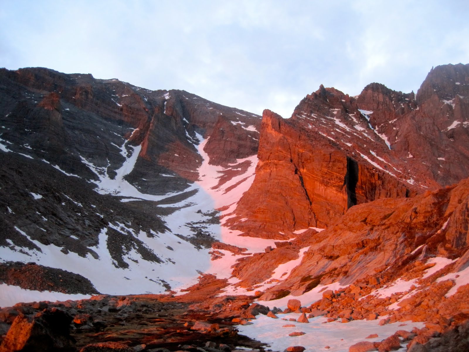
Mount Moran and the Skillet Glacier
Bad weather and lack of snow forced us out of Colorado and into the always stunning Tetons. We pulled into the park around 2 pm and stopped by the Jenny Lake ranger station to get some permits to camp by one of the lakes. We asked about skiing the Skillet and were told, "That is DEFINITELY not recommended right now." We were told the conditions were like midwinter with unconsolidated snow and high avy danger. They even tried to scare us off reporting an avalanche and partial burial at the lower saddle headwall that had occurred TWO weeks earlier. Sheesh. Not that we're gnarly experts or anything, but it was obviously not as they reported. We kindly asked for our permits anyway and went to check it out.
Dressed to the nines and carrying skis along the Leigh Lake trail we got some odd looks Rightfully so, as we were in 3/4 tights with matching neon green shirts. But most of the quizzical looks were accompanied by questions about where the heck we were going to ski. Guess no one bothered to look up at the snow draped mountains.
Once the lakes thaw, most sources seem to recommend taking a boat across Jackson Lake or String then Leigh Lakes to approach the Skillet Glacier. We didn't feel the hassle was worth it and opted for the super mellow FLAT 4 miles along the shoreline of String, Leigh, Bearpaw, and Trapper lakes to where the trail ended. At the end of Trapper Lake, we found a campsite complete with a fire ring, chopped wood, benches, and perfectly flat ground. We couldn't resist, but decided we'd finish the approach and drop our skis at the base of the Glacier. Since the last mile would be bushwhacking through unknown terrain, we wanted to figure it out in the light. On the way out, we were attacked by shrubs, branches, thorns, and rocks. The way back by comparison, was a joy, as we followed deer trails, angling from the lateral moraine southeast through the trees. So for those who may use this approach, the easier way is to head north from Trapper Lake while always bearing slightly left (uphill into the pine trees) until you find yourselves boulder hopping directly below the Glacier.
We got an early start and had little trouble finding our way back to our skis. Pretty soon, we were skinning in the morning alpenglow.
5000 feet and a couple hours later
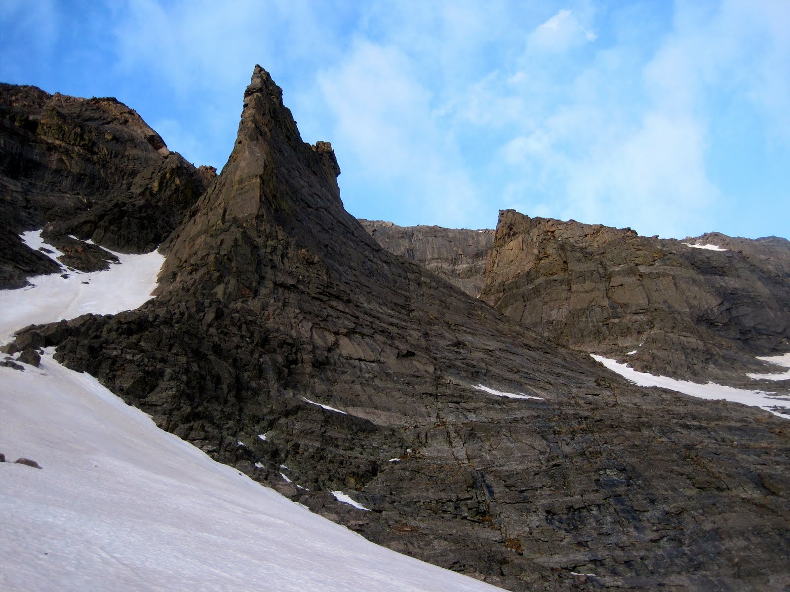
From the notch at the top of the upper handle, it's only a couple hundred feet south to the true summit. JD on the summit of Mount Moran, 12,605
The heart of the Tetons, now without JD ruining the picture.
The Hidden Couloir on Thor Peak beckons for another day
Perfect weather with adequate snow straight from the summit
From the notch, elated
Here's a series from the upper part of the Skillet. Photos by JD


Pretty blissful stuff. Even the hike down the broken deer trails back to the tents was peaceful. But then...
 A marmot was messing with my tent as we got close to camp so in an idiotic moment I tossed a rock and it and well...put that hole in my tent. Genius.
On a little side note, the whole day was fueled by half a pop tart. No, not half a package. Half of a single pop tart. About 3/4 of the way up we realized we hadn't had anything to eat since leaving the tents. We didn't want to stop, and nothing really sounded good. Too much Gu and bars over the last few weeks I guess. Anyway, we have been on a kick lately to eat nothing on the descent and hike out so as to make our first meal that much better (we always have food if needed but try to save our appetites to really binge once off the mountain). This time, the fast was on from the beginning, and you better believe the McDonald's was mind blowingly DELICIOUS!
And, on another side note, this is a line I would highly recommend. A runnel is forming and some wet debris is present but both are easily avoidable. Better get on it soon.
As Modest Mouse says, "Blame it on the Tetons." The love affair continues.
Back in SLC...
Dressed to the nines and carrying skis along the Leigh Lake trail we got some odd looks
 Rightfully so, as we were in 3/4 tights with matching neon green shirts. But most of the quizzical looks were accompanied by questions about where the heck we were going to ski. Guess no one bothered to look up at the snow draped mountains.
 Once the lakes thaw, most sources seem to recommend taking a boat across Jackson Lake or String then Leigh Lakes to approach the Skillet Glacier. We didn't feel the hassle was worth it and opted for the super mellow FLAT 4 miles along the shoreline of String, Leigh, Bearpaw, and Trapper lakes to where the trail ended. At the end of Trapper Lake, we found a campsite complete with a fire ring, chopped wood, benches, and perfectly flat ground. We couldn't resist, but decided we'd finish the approach and drop our skis at the base of the Glacier. Since the last mile would be bushwhacking through unknown terrain, we wanted to figure it out in the light. On the way out, we were attacked by shrubs, branches, thorns, and rocks. The way back by comparison, was a joy, as we followed deer trails, angling from the lateral moraine southeast through the trees. So for those who may use this approach, the easier way is to head north from Trapper Lake while always bearing slightly left (uphill into the pine trees) until you find yourselves boulder hopping directly below the Glacier.
We got an early start and had little trouble finding our way back to our skis. Pretty soon, we were skinning in the morning alpenglow.

5000 feet and a couple hours later

From the notch at the top of the upper handle, it's only a couple hundred feet south to the true summit. JD on the summit of Mount Moran, 12,605

The heart of the Tetons, now without JD ruining the picture.

The Hidden Couloir on Thor Peak beckons for another day

Perfect weather with adequate snow straight from the summit

From the notch, elated

Here's a series from the upper part of the Skillet. Photos by JD


Pretty blissful stuff. Even the hike down the broken deer trails back to the tents was peaceful. But then...
 A marmot was messing with my tent as we got close to camp so in an idiotic moment I tossed a rock and it and well...put that hole in my tent. Genius.
 On a little side note, the whole day was fueled by half a pop tart. No, not half a package. Half of a single pop tart. About 3/4 of the way up we realized we hadn't had anything to eat since leaving the tents. We didn't want to stop, and nothing really sounded good. Too much Gu and bars over the last few weeks I guess. Anyway, we have been on a kick lately to eat nothing on the descent and hike out so as to make our first meal that much better (we always have food if needed but try to save our appetites to really binge once off the mountain). This time, the fast was on from the beginning, and you better believe the McDonald's was mind blowingly DELICIOUS!
And, on another side note, this is a line I would highly recommend. A runnel is forming and some wet debris is present but both are easily avoidable. Better get on it soon.
As Modest Mouse says, "Blame it on the Tetons." The love affair continues.
Back in SLC...
Tuesday, June 15, 2010
Dead Dog Couloir, Torrey's Peak
Still bumming around Colorado with JD and my dad, we were looking for something to do the day after our RMNP adventure. My pops, who is getting ready for a trip to Mount Rainier, thought a snow climb at elevation and on the heels of a pretty big day would be excellent training. Viking Lars had skied the Dead Dog earlier in the year and said it would be to our liking.
Liking the line, JD and pops hiking toward the DDC which angles looker's right from the summit
Near the base of the climb, we bumped into some members of the Colorado Mountaineering Club. They moved surprisingly well and conveniently put in a nice booter to the summit.
Three generations
At the top, our old man decided he'd prefer the company of people without skis and walked off the south ridge with the club. Meanwhile, JD and I skied slushy, dirty snow down to a nap along the trail until Mike D caught up on foot.
 Dirt, rocks, and a good runnel...Colorado's finest.

Our first Colorado 14er. It's what... 53 to go?
Liking the line, JD and pops hiking toward the DDC which angles looker's right from the summit

Near the base of the climb, we bumped into some members of the Colorado Mountaineering Club. They moved surprisingly well and conveniently put in a nice booter to the summit.
Three generations

At the top, our old man decided he'd prefer the company of people without skis and walked off the south ridge with the club. Meanwhile, JD and I skied slushy, dirty snow down to a nap along the trail until Mike D caught up on foot.
 Dirt, rocks, and a good runnel...Colorado's finest.
Our first Colorado 14er. It's what... 53 to go?
Saturday, June 12, 2010
RMNP - Snow and Rock - w/Pops
Well, we're back on the road again. Jason, our old man, and I left SLC Tues morning and that afternoon found ourselves in Rocky Mountain National Park under stormy skies with wavering enthusiasm for our mixed climbing objective, Dreamweaver, on Mt. Meeker. We were hoping to find ice, snow, and rock up this classic line, but 90 degree temps for the past week and pesky thunderstorms the day before threatened to ruin the whole trip. Rather than sit in the rain, we ran back down to Estes Park for some DQ, then tried to sleep a bit before our planned 3:00 AM start.
Packing was quite an ordeal since I only brought my Avalung pack but somehow managed to cram rope, rack, harness, ice screws, 2 ice tools, skis, boots, poles, sleeping bag, pad, bivy sack, puffy, rain shell, my Crazy pants, gloves, crampons, and food for 2 days. I looked like a total bag lady with stuff clipped everywhere.
The hike up into Meeker Cirque or the Mills Glacier is an easy 3 miles along a wide mellow trail. We were rewarded for our diligent alpine start with brilliant morning alpenglow.
Dreamweaver ascends to the left of the flying buttress.
Jason on one of the rock steps. Obviously, no ice had formed during the unusually warm spring Why does he have skis?
My dad getting after it
Mike D near the top of Dreamweaver
Long's Peak shrouded in clouds
We caught up to a guided party near the top. Jason was still totting around those skis. Why?
Ahhh, we found some dirty snow in the Loft. Not really a destination ski line, but it was fun with a little rappel in the middle.
JD just below the rappel
Mike D took the loft bypass to avoid the rappel as he was hiking down. That guy needs to get some skis. And we needed to be in the park about 2 weeks earlier. There would be great ski descents like Keplinger's on Long's, the Dutchman, Lambs Slide, the Notch, and more, but you'd need skills like this guy with the current lack of snow.
Dreamweaver on left, Loft with tracks on right
Pretty fun day with three generations out in the mountains. We took a look at the Flying Dutchman, but it looked like a sloppy mess so we said goodbye to the park in search of more adventure. More with Mike D to come...
Packing was quite an ordeal since I only brought my Avalung pack but somehow managed to cram rope, rack, harness, ice screws, 2 ice tools, skis, boots, poles, sleeping bag, pad, bivy sack, puffy, rain shell, my Crazy pants, gloves, crampons, and food for 2 days. I looked like a total bag lady with stuff clipped everywhere.
The hike up into Meeker Cirque or the Mills Glacier is an easy 3 miles along a wide mellow trail. We were rewarded for our diligent alpine start with brilliant morning alpenglow.
Dreamweaver ascends to the left of the flying buttress.
Jason on one of the rock steps. Obviously, no ice had formed during the unusually warm spring
 Why does he have skis?
My dad getting after it

Mike D near the top of Dreamweaver

Long's Peak shrouded in clouds

We caught up to a guided party near the top. Jason was still totting around those skis. Why?

Ahhh, we found some dirty snow in the Loft. Not really a destination ski line, but it was fun with a little rappel in the middle.

JD just below the rappel

Mike D took the loft bypass to avoid the rappel as he was hiking down. That guy needs to get some skis. And we needed to be in the park about 2 weeks earlier. There would be great ski descents like Keplinger's on Long's, the Dutchman, Lambs Slide, the Notch, and more, but you'd need skills like this guy with the current lack of snow.
Dreamweaver on left, Loft with tracks on right

Pretty fun day with three generations out in the mountains. We took a look at the Flying Dutchman, but it looked like a sloppy mess so we said goodbye to the park in search of more adventure. More with Mike D to come...
Tuesday, June 8, 2010
Monday, June 7, 2010
Lurking Fear, El Capitan

Located on the far left of the Southwest face of El Capitan, Lurking Fear is perhaps the easiest route to the summit but offers less moderate free climbing and a bit more sustained aiding than it's more popular brothers like the Nose or Salathe.
Fatigued from thousands of miles in the car and nights on the ground we camped outside the park Sunday night at a dirt pullout off highway 140. Rolling into the park early Monday morning to try and secure a spot in Camp 4, Jason and I were rather unenthusiastic about the work ahead. Packing for a couple days on the wall, humping huge loads to the base of the climb, accustoming ourselves to the pace of climbing after so much skiing...it all seemed heavy and slow.
Our original plans had been to try and climb the Salathe wall and then just keep working away at the endless classics in the Valley. Big talk of multiple El Cap routes or long free climbs seemed to destined to be just that...big talk.
We settled on Lurking Fear as a "warm up" because it required relatively little mandatory free and Jason's ankle was still swollen and discolored from his awesome bouldering fall in Portland. Supertopo says fast parties fix to 3, fire the next day, and bivy on 10 and 17, topping out the morning of day three. Figuring we'd take our time to work out some of the big wall systems since I'd slighted Jason on my other big wall adventures and this was his first really aid intensive route, we planned on the full "fast party" 3 days. Water for two people for three days plus the descent is about 20 liters give or take depending on the temperature. Add that to a massive aid rack, portaledge, poop tube, bivy gear, etc, and you get packs in excess of 100 pounds. And to think Jared was complaining about a 16 pound pack, sheesh.
Well, after a rather apathetic start, we gained momentum and were soon established on the wall.
JD jugging up to the Pillar of Dispair, pitch 9

Views of the Cathedral Rocks in the long hours of early evening

View from our bedroom in the morning

View from the bathroom in the morning

The second day was pretty cruiser with the only hiccup being a short fall JD took right after this pic was taken

With two pitches to go and getting hungry for the summit as well as dinner, we pulled onto Thanksgiving Ledge, which has to be one of the coolest places in the world to spend a night just kicking it. We were ambivalent as to whether or not we should continue. In the end, food hunger won out and Jason was happy.

We feasted on canned peaches, Mountain House lasagna, soup, ramen, and dried fruit, and we were asleep before dark, tucked away in our little cave in the side of the cliff. We felt secure enough to unrope and take off our harnesses but did string all our gear along the entrance just in case we did roll a bit too far toward the cliff's edge.
The next day... Summit!
Psyched to be done climbing but my legs were sore for next 3 days from all that stuff.

Realizing that we'd have to take a couple rest days (and that I missed my cute wife) we drove through the night to get back to the comforts of home rather than stay in Camp 4. We are finishing up our rest period and tomorrow it's back to the road...
Friday, June 4, 2010
Volcano Tour 2010 Wrap Up
Our week in the Pacific Northwest was an overwhelming success in spite of the weather forecast that looked like: rain, rain, mostly sunny, rain, rain, rain, rain, rain.
A few quick stats:
- 5 Ski Days
- 35,000 vertical
- 4 volcanos summited and skied (Adams, Rainier, Hood, Shasta)
- 1 Thwarted Attempt on Mt. Baker due to nauseating whiteout conditions above 8,000'
- 3,553 miles driven (with detour through Yosemite)
- Surprisingly, only 3 meals at McDonald's
- Eaten - one doughnut shaped like male genitalia from Voodoo Doughnuts in Portland
- 1 sprained ankle
- 3 stinky dudes
As posted previously, we managed Mt. Adams while all the other peaks were shrouded in clouds, and scored Rainier under splitter blue skies. I left SLC on May 21st and drove up to Portland where I picked up Jason and viking Lars who flew in from Indy and Denver respectively. We grabbed some groceries and drove out to the Adams' trail head which was conveniently located 5 miles from the real trail head due to lingering snow which kept the approach road closed. Sleeping at the roadside, we donned ski boots and were hiking "Teton Style" at 5 AM. Stupid. Anyway, 8,000 vertical later...
Lars finding his way back to the cloud deck

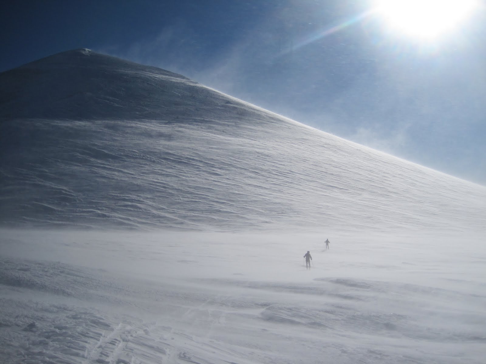
Sunday was a rest day as we drove up to Paradise on Rainier to secure permits and inquire about the weather/route conditions. We had planned on skiing the Emmon's Glacier, but the standard Ingraham Direct was "In" and had a much more convenient approach that still topped 9,000'. That night we ate at a sherpa restaurant, stayed at the Whittaker Bunk House, and then woke up at 2:00 AM. We were skinning from the car at 3:30 under clear skies and the thousands of vertical began ticking away.
Gorgeous morning

Looking back through Cadaver Gap toward Camp Muir, with Mt. Adams looming beyond
After a couple hours we began passing parties that had camped higher on the mountain. They were roped up as teams of 2-5+, hiking as slow as ants, unenlightened to the thought of snow travel eased by skis.

Looking back through Cadaver Gap toward Camp Muir, with Mt. Adams looming beyond

After a couple hours we began passing parties that had camped higher on the mountain. They were roped up as teams of 2-5+, hiking as slow as ants, unenlightened to the thought of snow travel eased by skis.
A look at the Ingraham Glacier with the route weaving through well bridged crevasses

We stood on the summit by 10 AM and were psyched to begin a 9,000' descent back to the car. The snow was variable but pockets of powder were still found up high. It's rare that one gets to feel like an absolute hero, but as we flew past the roped parties, mouths agape, we caught phrases here and there like, "BAD ASS!" Yeah, even though around most parts, we're nothing special, it felt pretty good to have our day in the sun.
JD on the Ingraham...about 8,000 ft to go

Viking Lars

Thinking all was well I brushed off and tried to ski and immediately wrecked again. I quickly found out that the peg on my boot that locks the buckle into ski mode had completely snapped off, confirming in my mind that D.N.As are as others have reported, a bit fragile.
Back at the car before noon we immediately turned our thoughts toward Mt. Baker and pointed the car north. We drove up to the standard trailhead for the Easton Glacier and camped in a dirt pullout, setting up just as the rain came to a stop. Baker is another relatively big day at 7,500' and we were feeling a little less than motivated as we sat on the tarp at 5:30 AM cooking breakfast, listening to music from the car, and laughing at Lars' puffy face, swollen from sleeping head down slope with out a pillow.

The clouds were low lying but glimpses of the sun were caught intermittently so we were off again. Baker sits among the North Cascades which are absolutely stunning and offer an apparent eternity of steep skiing.

Around 8,000 ft, we hit the clouds and everything turned into a dangerous whiteout. Unable to discern up from down and only having a vague sense of where they summit lay, we did the only reasonable thing...fashioned a big pit to wait it out.

Unfortunately, the storm intensified and as we were unprepared, lacking wands and a map, we turned tail cursing Mt. Baker and the Pacific NW rain.
Still having fun though

A bit bummed about having our streak ruined, we headed back south, contemplating some interesting lines in the Tatoosh Range which while on Rainier look like mole hills but are super rugged and worthy little peaks.
Lane Peak with multiple striking couloirs. (Photo stolen from summitpost.org)

The rain, however, continued through the next day and the Tatoosh were not to be. So we went to Portland to stay with a friend and bouldered at a local gym where Jason rolled his ankle on the first problem of the day. $12 for a sprained ankle...good deal? Thinking flexy F1s would be more or less like an ankle brace, he sucked it up for the next day's objective, Mt. Hood.
On the drive up to Timberline Lodge, we were sure we'd get turned back again. Even the lifts were obscured by clouds and none of us had been on the mountain previously. Except this time we brought a couple secret weapons: a map, and about 300 wands (construction flags available at Home Depot, 100 for $7). We followed the lift line like braille and Jason gave us a 1 in 15 chance of making the summit. He'd be a terrible forecaster. After a snack, the clouds parted and the summit showed herself, completely coated in rime ice. We made a mad dash, dropping wands every 40-50 meters in case the ever threatening clouds moved back in.

A quick skin up the Hog's Back,

And a booter to the Pearly Gates,

led to some climbing through moderately steep rime ice and snow

and we found ourselves on the summit, again engulfed by clouds but thrilled at another summit and 5,400' of fun at our ski tips. On the way down, the clouds again parted and...
Blessed again.


We felt we'd stolen another peak from the weather gods, who must have had enough with our foolish/bold attempts because the next couple days the forecast (from the real forecasters, not Jason) was more rain...heavy rain. And, to complicate matters, the permits for Mt. St. Helens were sold out until the weekend. Ridiculous. Furthermore, the trail head for St. Helens starts at 2,700 ft or so, making the first few thousand ft of the climb on dirt and in the rain.
A meeting of the minds and a 100% guarantee (from Jason) that we'd have success prompted us to jump back in the car and drive 6 hrs south to Mt. Shasta. There was real appeal to this new plan because it would "guarantee" that we'd tag the 4 highest volcanoes giving the trip a nicer symmetry.
A 3:30 start put us in position to blow by all those on foot while still relatively low on the mountain. Again, we were the only ones on skis, and all the traditional "mountaineers" who had camped 3500 feet up, appeared utterly defeated as they stood knee deep in the new powder and watched us climb past. From that point on, we had the whole mountain to ourselves.
The morning was beautiful only in appearance. Savage winds scoured the mountain and nearly knocked us off our feet repeatedly. It was hardshells, zipped to the top, hoods on, type of weather.
Shasta Shadow

Skinning toward the Heart. Our descent wound through some chutes in the center of the photo

Above Heart and heading for Misery Hill, just below the summit plateau. Winds WHIPPING (Video to come)

I didn't even pull out my camera on the summit because the wind was intolerable. Once in the lower chutes to the "left of Heart," we found some protection and undisturbed prime volcano powder.

JD

Jason's guarantee fulfilled


Victory

Volcano Tour...Over

Next up...Yosemite Valley
Subscribe to:
Posts (Atom)